Northern Britain Battling Storm Boelo: Travel Chaos and Flood Fears
Amber warnings have activated across the UK's north as gusts exceed 70mph, grounding flights and forcing major event cancellations.
By Lucy Lefebvre ·
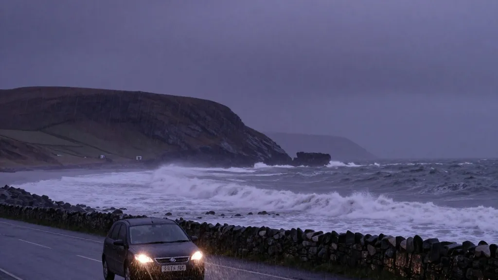
Storm Boelo has locked its grip on northern Britain, triggering the second-highest level of weather alerts from the Met Office. Amber warnings went live at 9pm on Saturday, covering mainland Scotland, the far north of England down to Carlisle, and a portion of Northern Ireland. These zones will remain under the alert until 9pm Sunday, with a separate timeline for Northern Ireland extending to 10am Sunday. Broader yellow warnings also cover North Wales and the rest of the country, signaling that widespread disruption is expected throughout the region.
The numbers underscore the severity of the situation. Forecasters predict widespread gusts of 60 to 70mph, with exposed coastal spots potentially reaching 80mph. Early readings already confirmed the threat. Winds hit 75mph in the Western Isles, specifically at the South Uist Range, and similar speeds were recorded in the Highland and Eilean Siar areas. Rainfall has also been substantial since 8am Saturday. White Barrow in Wiltshire collected 72mm of water, while Cwm Dyli in North Wales and Inveruglas in Scotland both logged 43mm.
The Environment Agency reacted to the deluge by issuing 58 alerts for possible flooding across England by 8pm Saturday. Additionally, 12 specific warnings indicated that flooding was expected in certain locations. This storm is the second named system of the season, following Storm Austen. That earlier event brought 76mph gusts to St Mary’s airport in the Isles of Scilly, 74mph to Aberporth in south-west Wales, and 71mph to Culdrose in Cornwall. While hundreds of homes in the southwest lost power due to Austen, the National Grid reported that 131,000 properties had regained electricity by 7pm Saturday.
Met Office chief forecaster Jason Kelly emphasized that the entire UK would feel the impact, though the north faces the harshest conditions. He advised the public to stay indoors to avoid flying debris and crashing waves. Kelly urged residents to secure loose outdoor items and plan their travel carefully while monitoring the latest forecasts. His guidance aims to minimize injury and property damage as the peak winds arrive.
Transport networks have already felt the strain. Dublin airport reported that airlines cancelled nine outbound and ten inbound flights by 4pm Saturday. Six inbound flights had to perform go-arounds, with five successfully landing on the second attempt and one diverting before returning. On the ground, Network Rail shared images of a trampoline and a shed near the tracks, highlighting the need for residents to fasten down garden furniture to prevent it from becoming a hazard.
Leisure activities have also been suspended to protect visitors. Visit Liverpool cancelled the River of Light event, which features illuminated artwork, citing safety concerns. In London, the annual Diwali on the Square celebrations planned for Sunday were called off after independent health and safety experts issued a recommendation. Major attractions followed suit, with Edinburgh Castle and the Fountains Abbey estate in North Yorkshire closing for Sunday. Fountains Abbey had planned to host its Fountains by Floodlight event, but the inclement weather forced the change.
The coordinated response underscores the scale of the event. From the highlands of Scotland to the squares of London, the storm is reshaping daily routines. Commuters face delayed journeys, and outdoor enthusiasts must wait for the winds to subside. The next 24 hours will be critical as the system moves through, with the Met Office continuing to track the progression of the amber and yellow zones.
For working families and travelers, the key takeaway is preparation. Securing loose objects and adjusting schedules can mitigate the risks posed by high winds and heavy rain. As the storm progresses, updates from the National Grid and local authorities will be essential for those affected by power cuts or travel delays. The season's second named storm is a reminder of the unpredictable nature of autumn weather in the UK.
Source: The Guardian